Projects
Mount Haggin Uplands Pilot Project
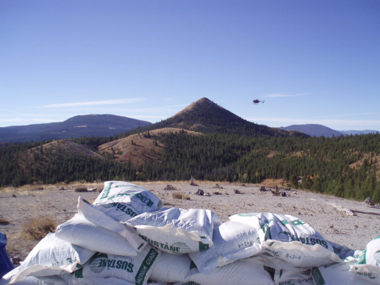
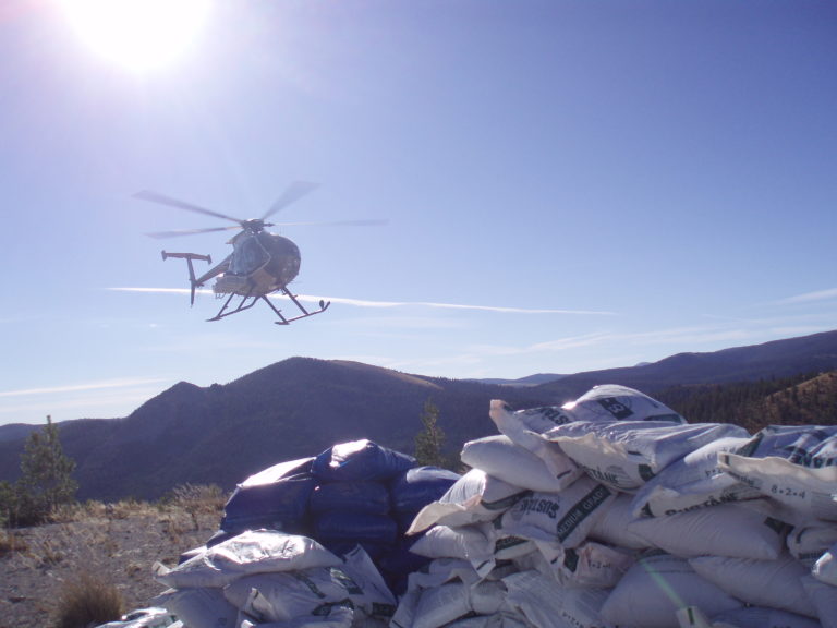
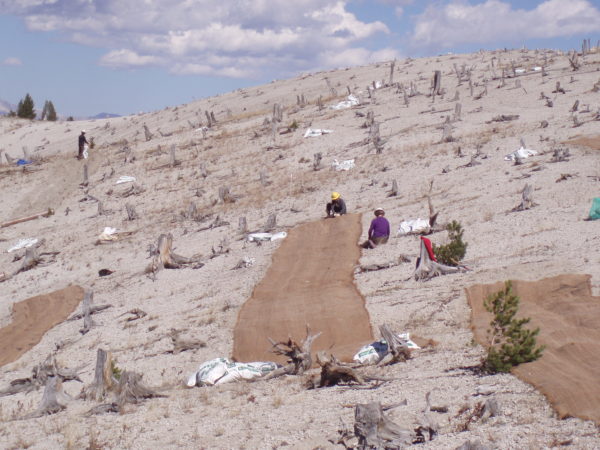
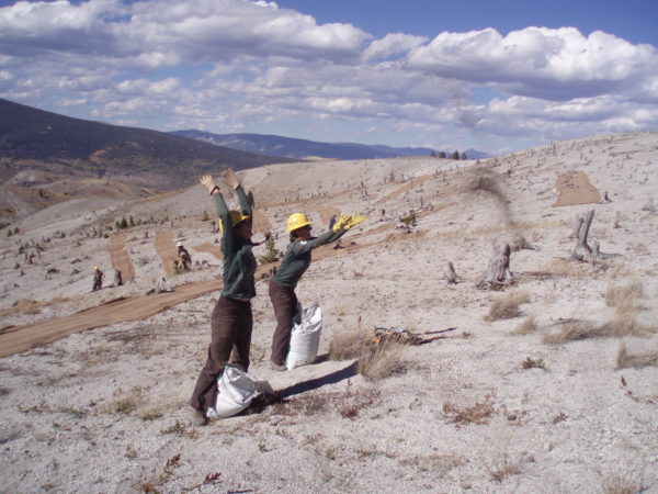
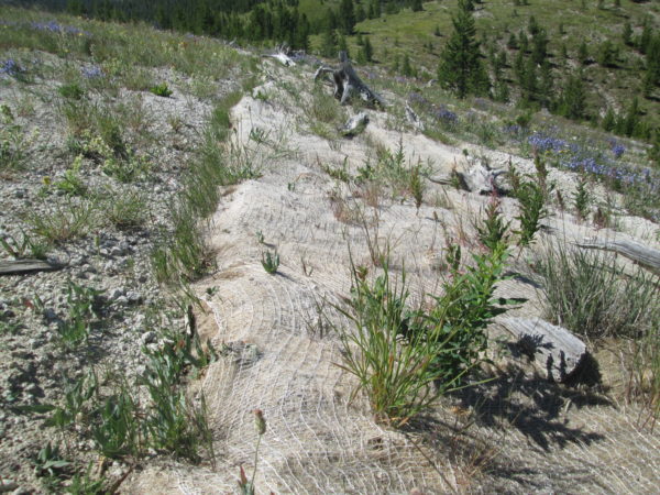
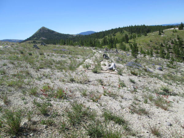
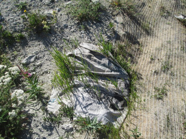
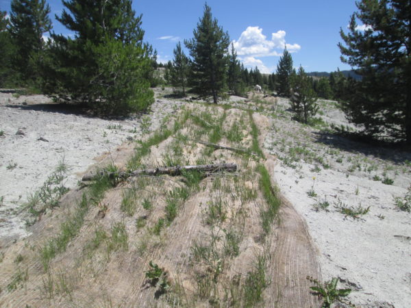
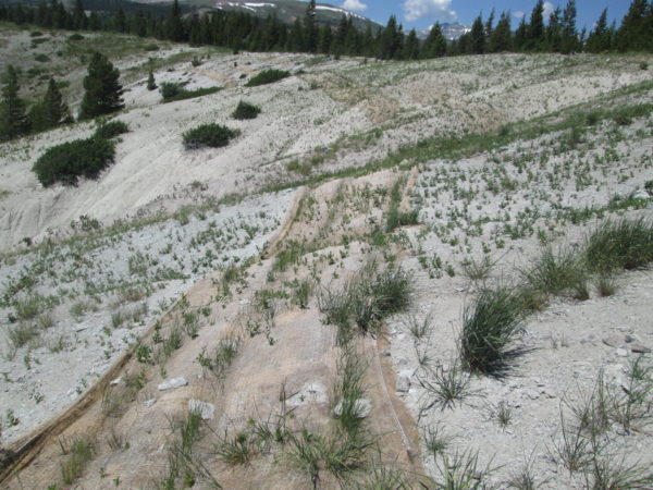
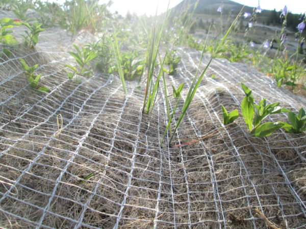
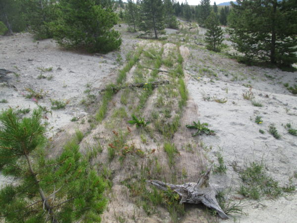
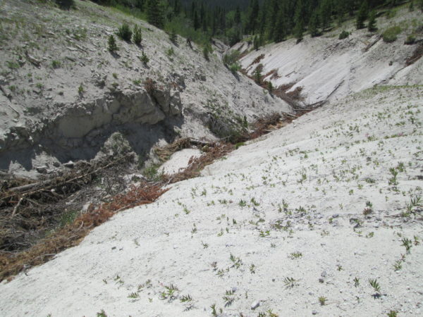
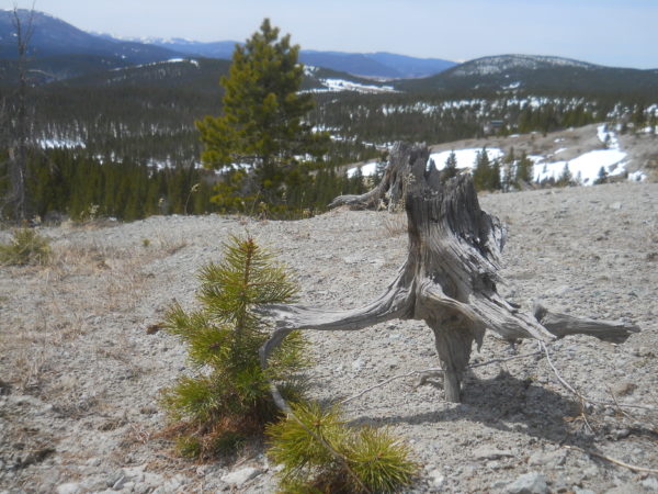
The goal of the Mount Haggin Uplands Revegetation/Sediment Control Demonstration project, completed 2016, was to mitigate sediment delivery from uplands and gullies into waterways and jump-start vegetation restoration on severely eroded upland slopes of the Mount Haggin WMA. This involved the completion of two upland restoration demonstration projects (one on either side of the divide) covering 6.8 acres of bare upland slopes and 1/2 mile of incised gullies. The project tested the efficacy of organic fertilizer and an upland seed mix for vegetation establishment in these harsh environments. It also demonstrated a scale-up of earlier experiments to benefit the State of Montana’s restoration of the Anaconda upland Superfund site.
Visit our YouTube channel for more project videos.
Area History
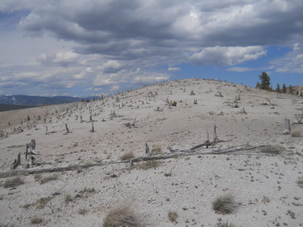
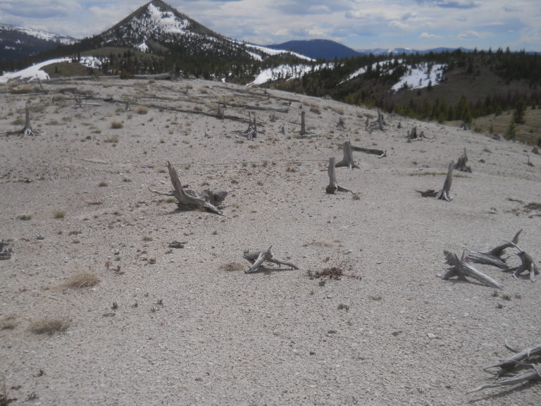
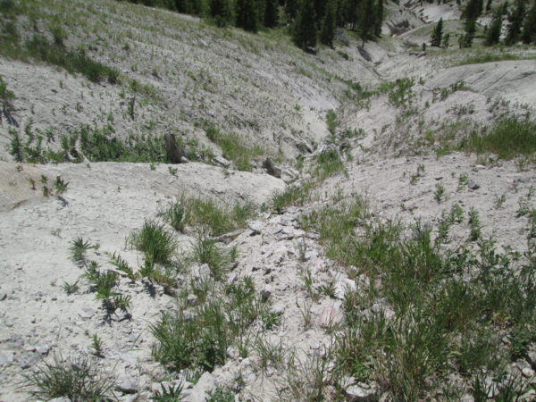
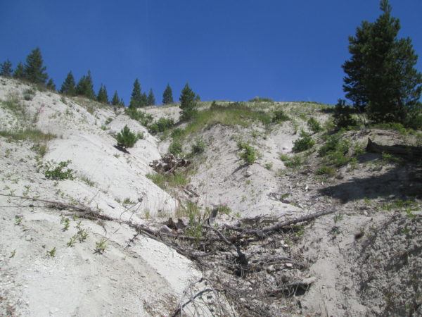
Aerial emissions from early 20th century smelting activities in Anaconda, together with extensive logging to fuel the smelters, have left areas in the Mt. Haggin Uplands (RDU 15) of the Anaconda National Priorities List (NPL)/Superfund site in a highly degraded state. Impacted areas lie within the state owned Mt. Haggin Wildlife Management Area (WMA) and include the watersheds of Joiner and Muddy creeks, flowing northwest into Mill Creek in the Clark Fork River basin and the headwaters of California Creek which flow south into French Creek in the Upper Big Hole River drainage. All three headwaters tributaries are near the continental divide.
Project Results
30-50% improvement in vegetation cover across 6.8 acres of highly degraded upland slopes
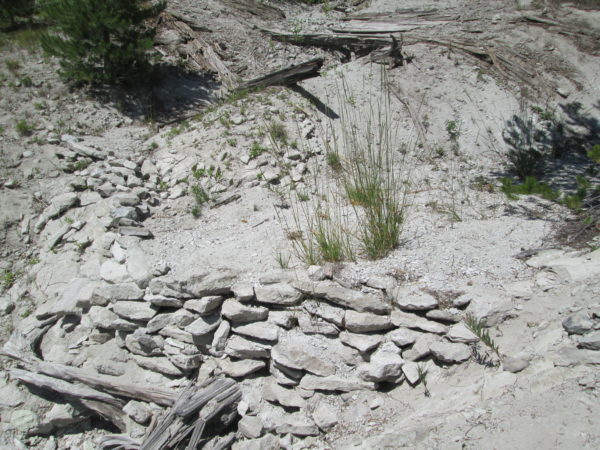
260 Cu. yds sediment catchment installed
BMP techniques and per unit costs established for scaling to larger projects.
People & Organizations Involved
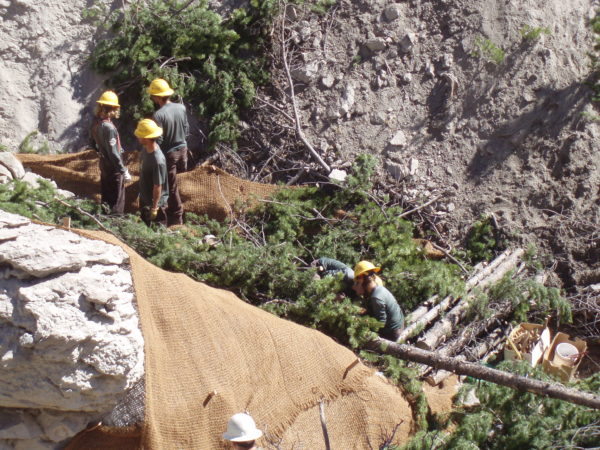
The Natural Resource Damage Program continues to coordinate this complex restoration landscape of the Mt. Haggin Uplands with state agencies, the EPA, and a network of contractors. The Big Hole Watershed Committee is a key partner in this work, bringing multiple funding sources to the table to address upland sedimentation issues affecting the Big Hole and Clark Fork Rivers. The Committee and contractors are using data from this project to inform basin-scale restoration plans for areas impacted by smelter emissions.
Montana Fish, Wildlife and Parks
Natural Resources Damage Program
Project Documents
Mount Haggin Restoration in Context
Project Photos
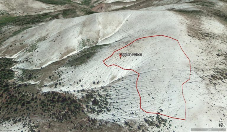
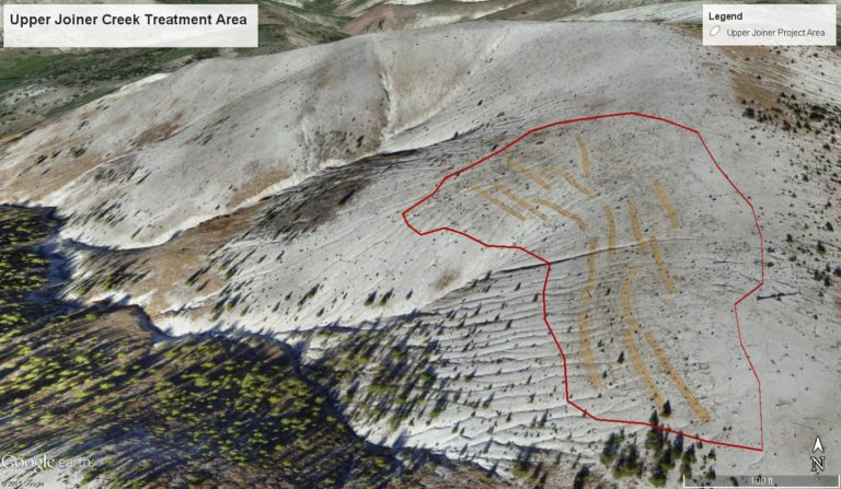
Project MAP
Status
Completed
Type
Streambank/Sedimentation