
Projects
Floodplain Mapping
Please note: While this project is shown in Wise River on the website’s current projects map, it actually covered the entire river, excluding the previously mapped stretch in Silver Bow County.
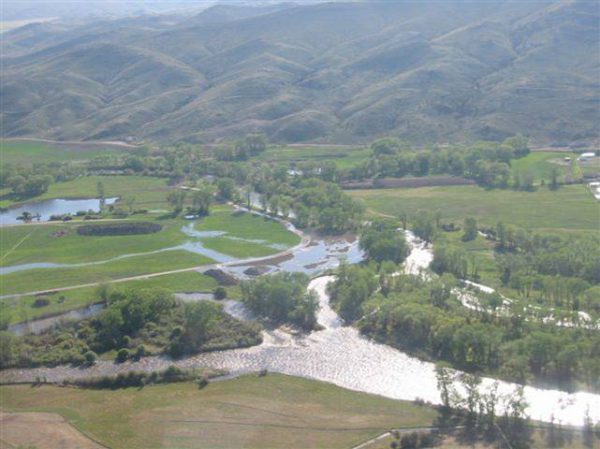
The Big Hole River Approximate Zone A (also referred to as the “100 year floodplain” or “1% flood probability”) Floodplain Maps were completed spring 2013. The mapping covered 116 miles of Big Hole River from headwaters to mouth, except the portion within Silver Bow County which had been mapped previously. Our river corridor rich with life, critical to the health of our river and fishery. Mapping and development standards help to encourage healthy development and limit damages to property and risk to safety as a result of flooding. Floodplain mapping also provides legally defensible products with which counties can regulate development within the floodplain. Appropriate river floodplain development is critical to protect property, ensure health and safety of the public and responders during floods, maintain the long-term sustainability and health of our river floodplain, and provide protections for water quality, river side vegetation, and more.
VIEW THE BIG HOLE RIVER FLOODPLAIN MAPS
The Big Hole River Approximate Zone A Floodplain Maps may be viewed online, here:
Big Hole River Floodplain Maps
Floodplain Map Adoption Process
Step 1: Create accurate Floodplain Maps – COMPLETE
Step 2: State of Montana Adoption – COMPLETE 10/7/2014
See order online:
http://dnrc.mt.gov/divisions/water/operations/docs/floodplain/big-hole/Big_Hole_Study_Order_2015.pdf
Intermediate Step
After state adoption, the state must submit the maps to FEMA for adoption. This process is expected to take several years to complete. The next steps are not dependent on this step.
Step 3: County Adoption & Floodplain Development Standards (CURRENT STEP)
Anaconda-Deer Lodge, Beaverhead, and Madison Counties. (Silver Bow County approved their floodplain maps in earlier mapping).
Each county may adopt floodplain development standards that will provide guidance on appropriate floodplain development, such as river set-backs, structure height, etc. The Big Hole Watershed Committee drafted recommended language for new development standards to encourage incorporation of riparian health standards as well as standardize floodplain development across counties. A letter of support was sent to counties April 2015 to encourage floodplain map and development standard adoption:
View the BHWC Letter of Support.
View BHWC Handout for County Adoption Process
The existing 150 foot setback floodplain standard is uniform among 4 counties, was developed by the BHWC Land Use Planning Committee, and remains in place.
- Beaverhead County adopted maps and new development standards January 1, 2016.
- Anaconda-Deer Lodge and Madison Counties are awaiting final map adoption.
People & Organizations Involved:
The BHWC Land Use Planning Committee led the effort to map the Big Hole River floodplain beginning in 2009. During this project, this subcommittee was led by facilitator Jen Boyer of Future West. The subcommittee included county planners, state floodplain advisors, landowners and interest groups.
Future West (project facilitator)
Montana Department of Natural Resources & Conservation
ATKINS (Mapping Contractor)
Montana Department of Environmental Quality
Project Documents & Resources:
View Big Hole River Floodplain Maps Online >>
Wikipedia’s description of the floodplain and why we map the floodplain.
The Nature Conservancy – “Why Rivers Flood and How to Reduce the Risk”
Montana DNRC Floodplain Management (Water Resources Division)
Project MAP
Status
Ongoing
Type
Resource Management/Planning