
Projects
Pennington Bridge Restoration
Update – Pennington Bridge Phase 2:
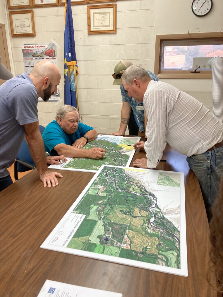
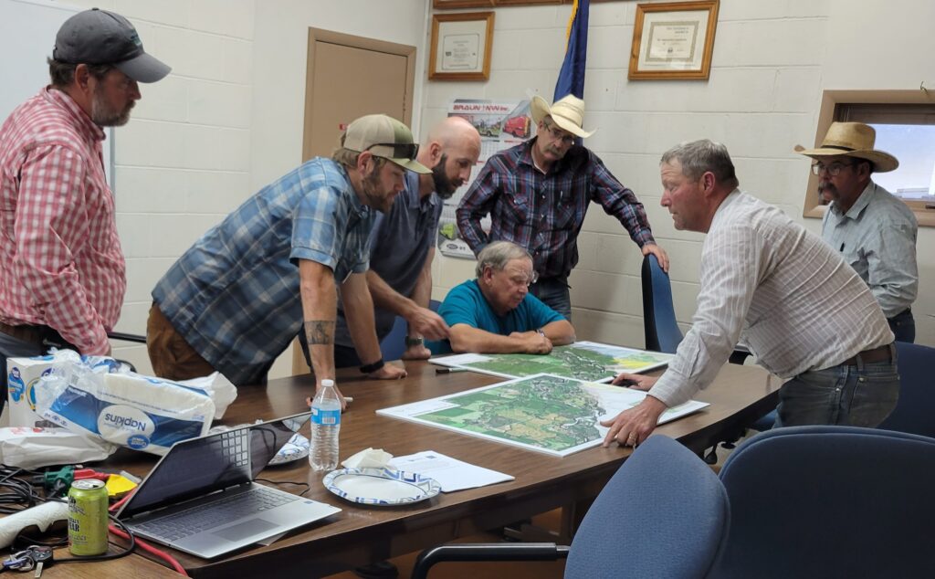
With grant funds from the Bureau of Reclamations WaterSMART program, BHWC has hired Great West Engineering and Applied Geomorphology to design a long-term solution involving activation of side channels and bank stabilization. BHWC will be actively engaging landowners in the lower section of the Big Hole and work with Madison County to co-develop a solution for this problem that provides for water reliability, safety to infrastructure and private property, and improve ecological function.
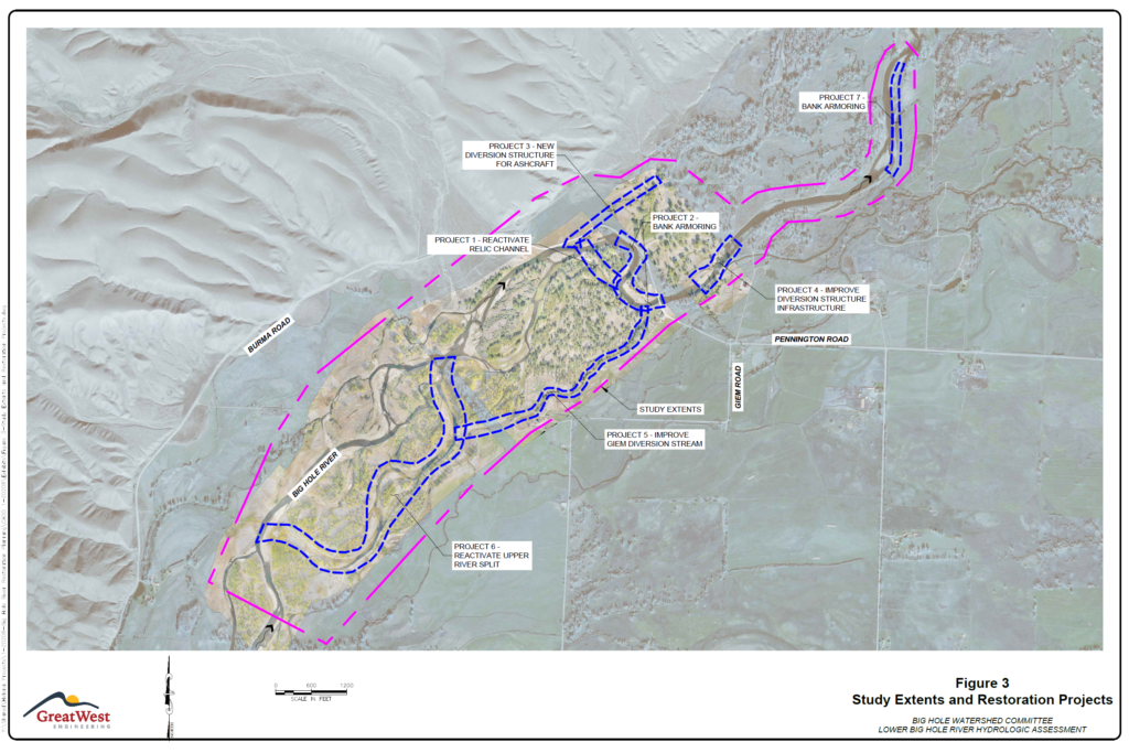
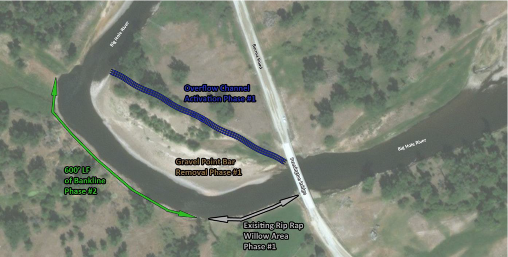
The images below shows the restoration phases identified by Great West Engineering. BHWC and partners will complete these phases as funds become available, starting with Phases 1, 2, and 3.
Project Description
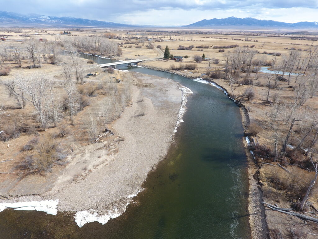
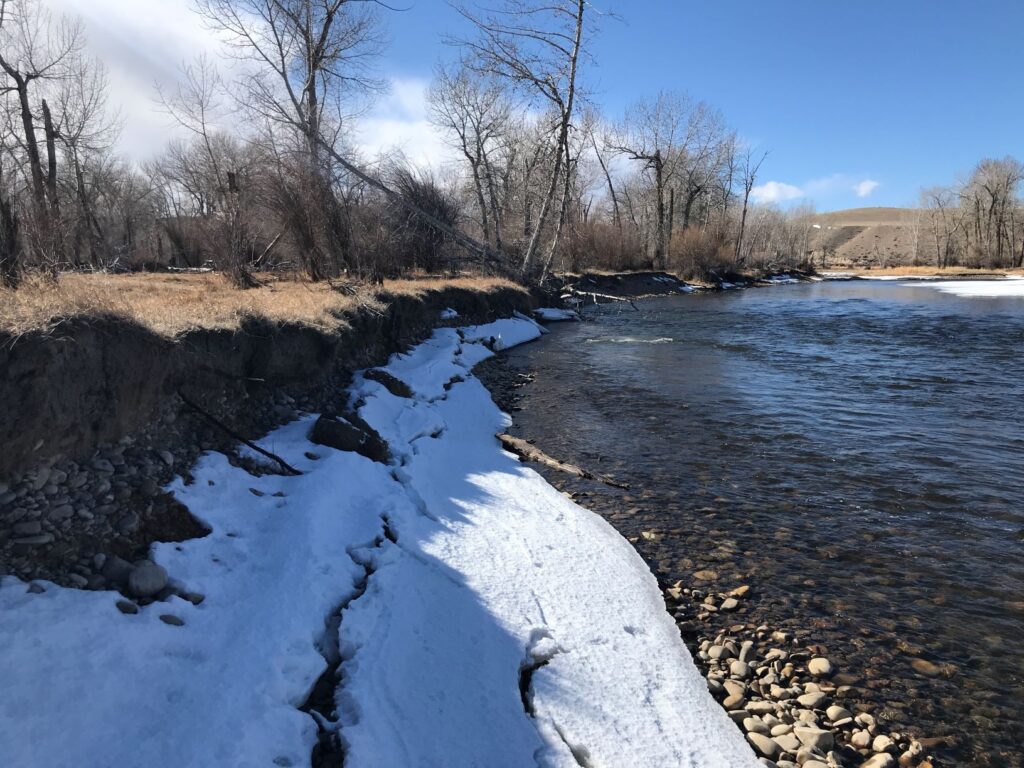
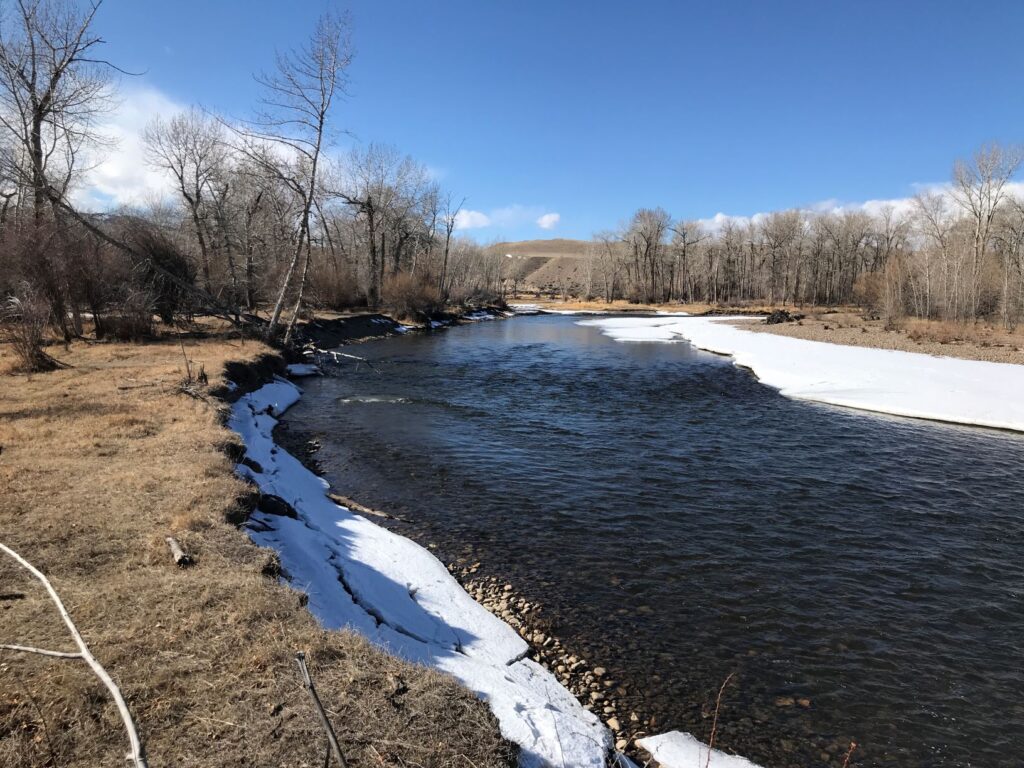
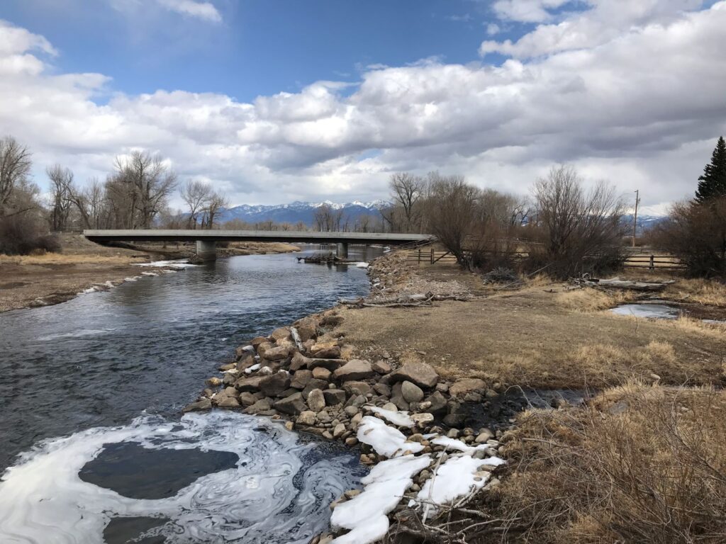
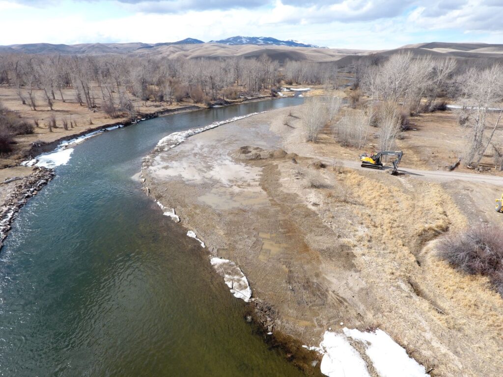
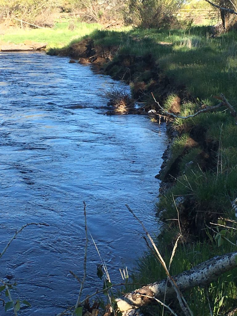
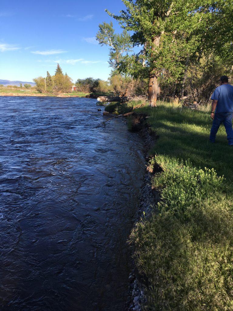
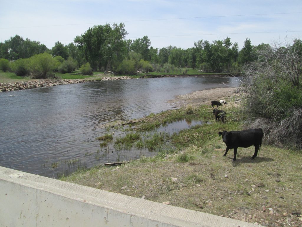
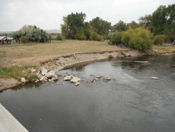
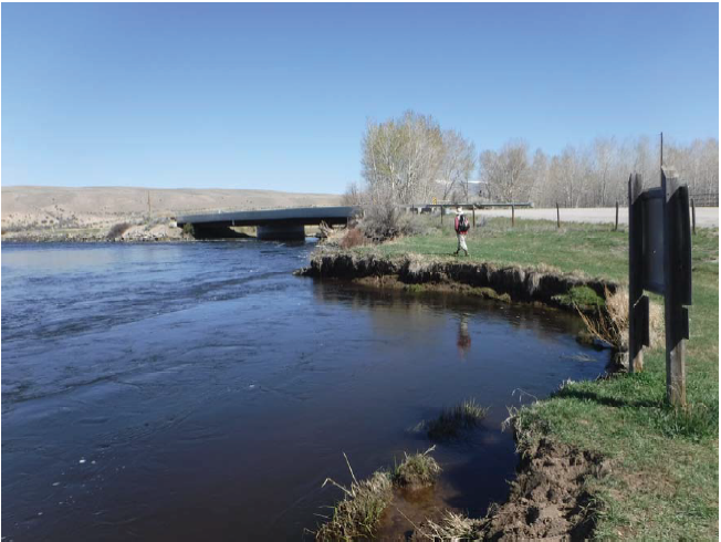
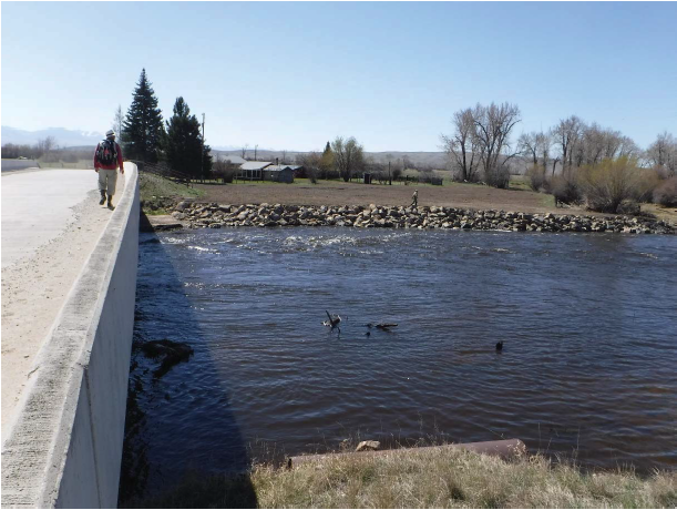
Due to two county bridges constraining the floodplain and side channels, this section of the lower Big Hole River has accelerated flows which have forced large-scale erosion and bank loss upstream of one bridge. In 2016, Madison County placed 175 cubic yards of riprap along 205 ft of the bank to protect the Pennington Bridge infrastructure and private ground. The riprap has held but is slowly being flanked by the river. This flanking, combined with the continual bank loss and erosion, poses a substantial risk to the Pennington Bridge abutments and infrastructure downstream. BHWC and partners are approaching this issue in two phases.
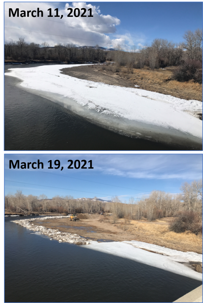
Phase 1 – Completed Spring 2021
We exceeded our fundraising goal of $1,500 to offset costs of the Pennington Bridge Phase 1 project, thanks to the generous contributions of 12 donors. A huge thank you to everyone who contributed! Total raised: $1,629.55
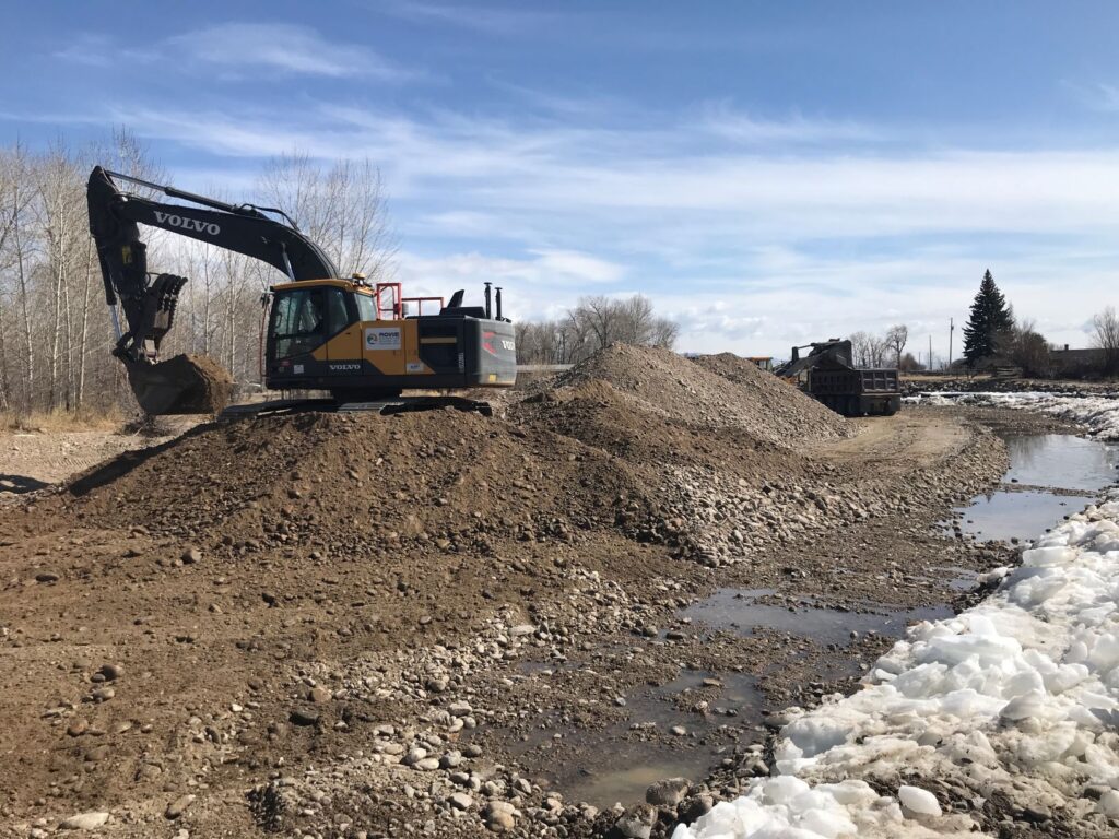
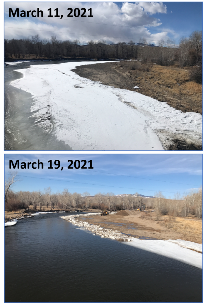
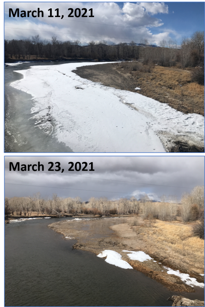
Phase 1 created a more effective solution to excessive sediment erosion from the crumbling streambank than continual rip-rapping. Removing the point bar activated an adjacent overflow/high flow channel, decreasing shear stress and erosive forces on streambanks. BHWC and partners also planted native riparian vegetation (mechanically transplanted willow clumps and hand-planted stakes/whips) on top of and throughout the existing 2016 rip-rapped bank.
Project Results
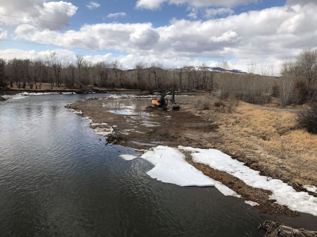
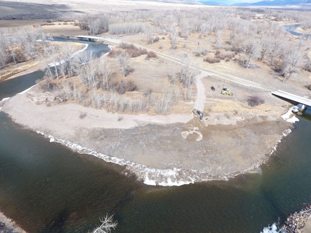
Phase 1-Complete
BHWC and partners removed 3,500 cubic yards of sand and gravel from a point-bar just above the bridge to ensure that the river stays underneath the Pennington Bridge while also reducing excessive erosion and sedimentation.
Phase 2-Ongoing
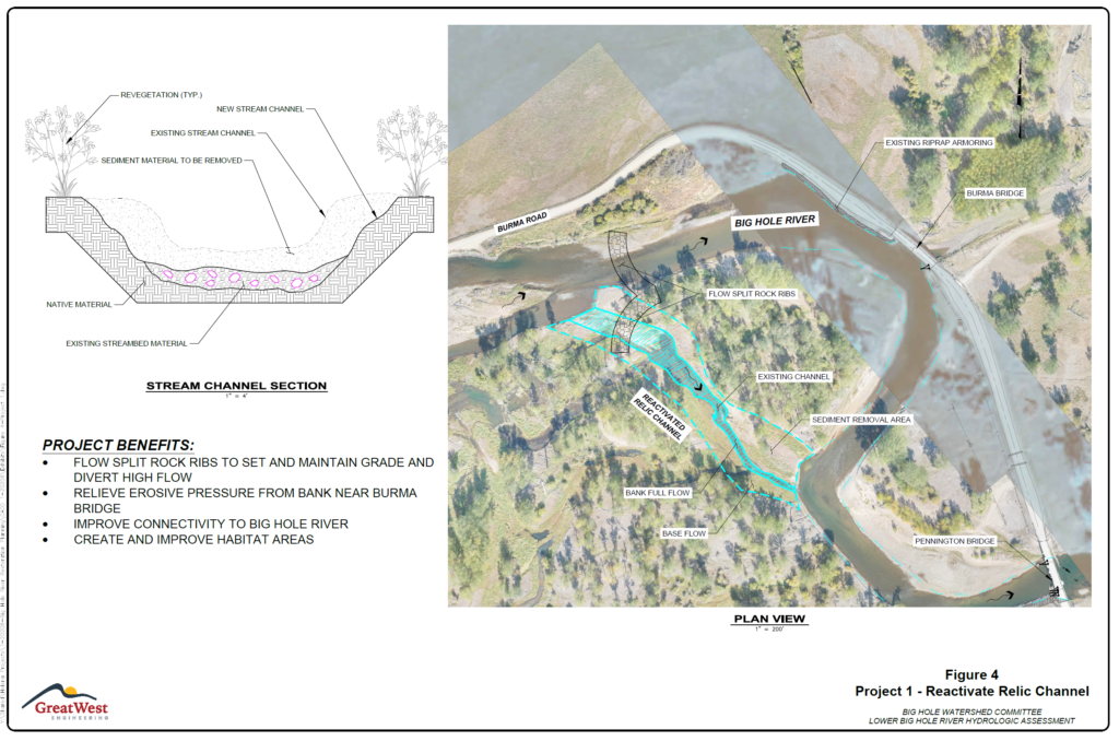
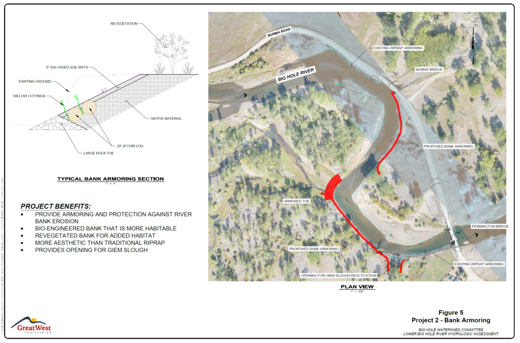
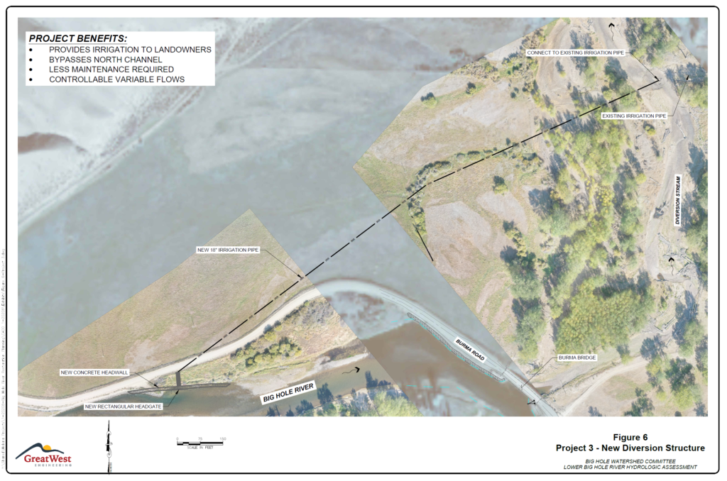
The objective of this project is to design and permit the first three projects identified in the Big Hole River Restoration Plan, which will address ongoing accelerated erosion and deposition happening along the Big Hole River, expanding one-mile upstream of the Burma Rod crossing and approximately one half-mile downstream. The projects include reactivating relic channels to provide flood relief in riparian areas and increase aquatic habitat; stabilizing riverbanks using strategically placed vegetated soil lifts along eroding banks; and constructing a new irrigation diversion and headgate to provide reliable water to irrigators which will eliminate the need to dredge the riverbed every year.
The Big Hole River Restoration Plan was developed by the Big Hole Watershed Committee through the use of a Bureau or Reclamation WaterSmart Grant with match contributions from Madison County.
People and Organizations Involved
Private Landowners
Montana Fish, Wildlife, and Parks
Funders
Montana Watershed Coordination Council
Natural Resources Conservation Service
Contractors
Applied Geomorphology Incorporated
Project Photos
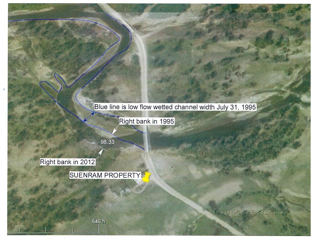
Project MAP
Status
In Progress
Type
Native Fish